Hiking Sweden's Kungsleden (the King's Trail) is an enormously civilised affair. When planning the trip I found online information to be a little sparse, which I now suspect is because Sweden doesn't need or want to shout about it too much. It's an absolute gem of a trail.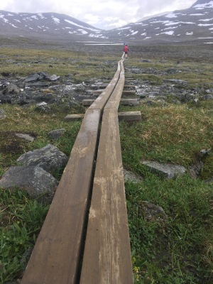
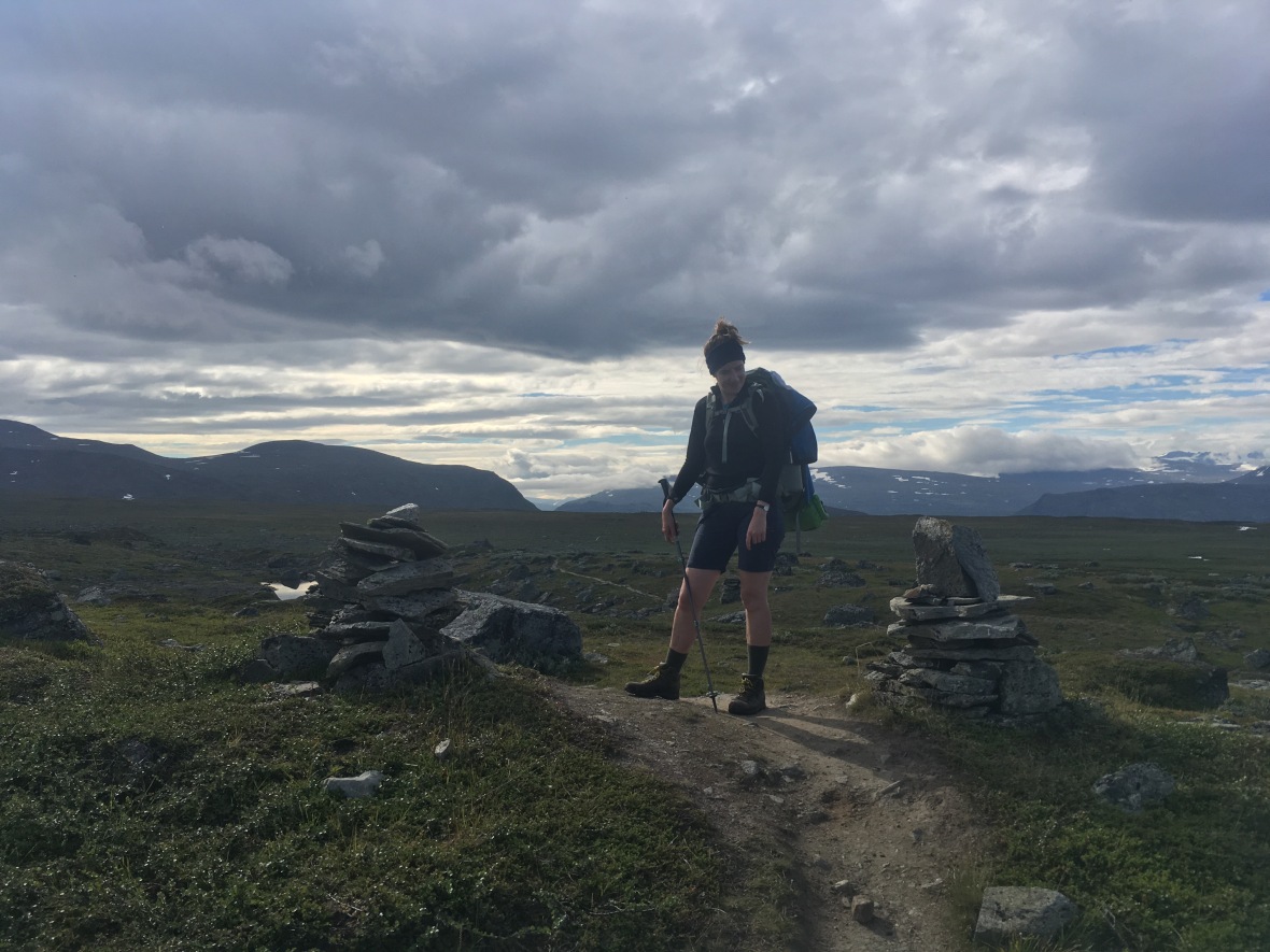
This 440km trail guides you from Abisko in the far north – 195km inside the arctic circle – to Hemavan. We are walking half the trail, as far as Kvikkjokk. This section is excellently marked, largely easy underfoot, and daily ascents reach no more than 400m. Despite this, the walk is almost entirely above the bushline, a veritable treat when schooled in NZ North Island tramping. The track crosses boulder-strewn valleys and alpine plateau, travelling between high mountains laced with the last of the winter snow. 
There are huts every 10-20km. I thought NZ had hut life pretty sorted but I'm afraid Sweden has really outclassed us. These large complexes in beautiful lake and riverside locations absorb hikers so don't feel crowded. If you want more space you can camp nearby and use the hut kitchen facilities or do your own thing outdoors. There's a marked spot for fresh water collection and another for bathing. After dinner you wander to the sauna and steam your aches and pains away, aided for the brave by intermittent cold dips in the river. Then you have a wash with water heated in the sauna's stove. Most huts have tiny shops selling tramping essentials such as food, suncream and… er… beer. 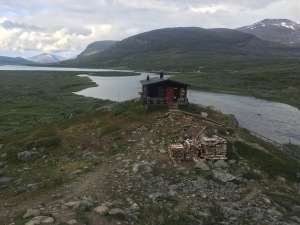
We're a few weeks past the Midnight Sun in July, where the sun doesn't set at all, but it still doesn't get dark. There's something a bit eerie about this at first, but I've come to quite like it. It gives everything a timeless quality: it doesn't really matter what time you rise or how long your breaks are, as you could walk through the night without torches. Plus it makes tent-based life pretty easy. 
I know what you're thinking: it isn't really a proper tramp without a highly irritating small flying biting insect ruining every picture-perfect lakeside picnic. Well never fear, for the omnipresent mosquito plays that role with aplomb. As for Sandfly vs Mosquito, the jury is still out, and it's expected to be a finely balanced case. But I hope that reassures you we're not having too much fun.
HOW WE SPENT OUR DAYS
Day 1: flight to Kiruna
Day 2: train to Abisko Fjällstation (Mountain Station)
Day 3: Abisko to Abiskojaure Hut 15km
Day 4: Abiskojaure to Alesjaure Hut 22km
Day 5: Alesjaure to Sälka Hut via Tjäkta Pass 25km
Day 6: Sälka Hut to Singi Hut 13km
Day 7: Singi Hut to Teusajaure Hut 22km
Day 8: Teusajaure Hut to Saltoluokta Fjällstation 16km
STATS OF THE TRACK
Highest elevation reached: Tjäkta Pass 1150m
Largest elevation gain: 420m
Reindeer/moose/elk spotted: one (but not sure which)
Saunas: four
Blisters: zero. Win!
Tubes of Squeezy Cheese consumed: one, and that's enough now
Amount of Sweden covered in blueberries: 30% (having seen none, it's possible we mistranslated this)
Swedish fluency gained: <0.1%
Plans to come back and ski the trail in winter: brewing


Noice
LikeLike
Looks awesome! Count me in for the ski tour!!
LikeLike
Wicked! I just have to learn to ski and get over my fear of snow then we’re totes good to go.
LikeLike
P.s. That’s an anonymous Clunas
LikeLike
Inspiring Fran. Viv
LikeLike
Hi, I am not sure if you still use this website of yours but I would like to know about the maps to use. I will ask further questions once I have a reply. Can you actually in that case email me atammiksalu@gmail.com
LikeLike
Hi there, yes fire away! Happy to help if I can.
LikeLike
Great post!
I am curious about the trek from Teusajaure Hut to Saltoluokta Fjällstation 16km. On google maps it says 46km including a ferry. So I am wondering if I am mistaken in what I have searched and/or that there is something I am completely missing from google maps?
Cheers
LikeLike